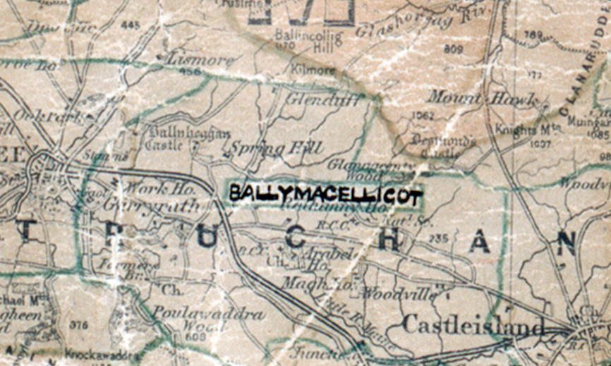
 Area: Ballymacelligot
Started: December 1947
Finished: April 1948
Poles used: 998
Line used (km): 90
Premises connected: 35
The figures above were sourced from our REO News magazine, to learn more about what these figures mean, visit our interactive map. The map above shows the area boundary and is from a digitised version of the original map used during the scheme.
Many of the area notes were handwritten hence the article in The REO News from February 1950. This digital scan from the REO News displays the following text:
The Dept. of Chief Accountant have a complaint. They say that if we had their problem of writing out the name of an Area as many times as they, we would keep to nice short names like Tara or Emly and would find some good reason for abandoning the Ballymacelligotts and Rochfortbridges, to say nothing of the double‑barrelled titles. It is not always easy or convenient to meet their point, there may be local complications, but it is worth trying where possible. This digital scan from the REO News displays the following text:
Post development is proceeding apace in all Districts but we will be forgiven if we select Tralee District for special mention. In the three areas, Ballymacelligott, Fenit and Ardfert, the number of additional consumers obtained on post development are 128, 80 and 166 respectively. There were a number of backsliders in these areas when originally developed. The new consumers will however, more than compensate for these.